
Oregon River Levels: A Comprehensive Guide and Forecast
Welcome to your comprehensive guide to Oregon river levels and forecasts! Stay informed about Oregon’s dynamic waterways with real-time data from NOAA and USGS. Anglers, kayakers, and anyone interested in river conditions can find critical information here, helping you stay safe and prepared.
Understanding Oregon River Levels
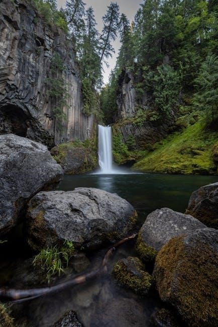
Oregon’s river systems are complex and vital to the state’s ecology and economy. Comprehending river levels involves understanding the factors that influence them, such as precipitation, snowmelt, and dam operations. River levels are typically measured in feet, indicating the water’s height relative to a reference point at a gauging station. These stations, often maintained by the USGS, provide continuous data on water levels and streamflow. Streamflow, measured in cubic feet per second (CFS), represents the volume of water passing a specific point per second; 100 CFS equates to a substantial 45,000 gallons per minute. Understanding these metrics is crucial for interpreting river conditions.
River levels fluctuate naturally due to seasonal changes and weather patterns. For example, snowmelt in the spring often leads to higher river levels, while drier summer months typically result in lower levels. Atmospheric rivers can bring intense rainfall, causing rapid increases in river levels and potential flooding. By monitoring these levels, one can assess the impact of these events. Accessing real-time data from the NOAA’s Pacific Northwest River Forecast Center (PNW) and USGS gauges is essential for staying informed. These sources provide valuable insights for recreational activities, flood preparedness, and water resource management.
Importance of River Level Data
River level data plays a crucial role in numerous aspects of life in Oregon. For recreational users, such as anglers and boaters, this data is essential for planning safe and enjoyable trips. Knowing the current river level helps determine whether a river is navigable, safe for fishing, or suitable for specific water activities. For example, low river levels may expose hazards, while high levels can create dangerous currents. River level data is equally important for flood forecasting and management. By monitoring river levels, authorities can anticipate potential flooding events and issue timely warnings to communities at risk.
This information enables residents to take necessary precautions, such as evacuating or protecting property. Furthermore, river level data is vital for water resource management. It helps agencies monitor water availability, manage dam releases, and allocate water resources effectively. This is particularly important during droughts or periods of high demand. Understanding river levels also aids in environmental monitoring, allowing scientists to assess the health of aquatic ecosystems and track the impact of human activities on water resources. Access to accurate and up-to-date river level data empowers individuals, communities, and agencies to make informed decisions and protect lives, property, and the environment.
Sources of Oregon River Level Information
Reliable and accessible sources of river level information are crucial for anyone living in or visiting Oregon. Fortunately, several organizations provide up-to-date data for various rivers across the state. The National Oceanic and Atmospheric Administration’s (NOAA) Pacific Northwest River Forecast Center (PNW) is a primary source. They offer real-time river level data, forecasts, and flood warnings. The United States Geological Survey (USGS) also maintains a network of gauges throughout Oregon, providing streamflow data, gauge height, and water temperature readings. These USGS gauges are invaluable for monitoring long-term trends and understanding current conditions.
Many websites and apps compile data from these sources, making it easier to access information for specific rivers. Some fishing websites provide links to NOAA and USGS data, along with additional information relevant to anglers. Local news outlets and weather services often report on river levels, especially during periods of heavy rainfall or potential flooding. Additionally, some counties and municipalities have their own monitoring systems and websites, providing localized information for specific areas. By utilizing these various sources, individuals can gain a comprehensive understanding of Oregon river levels and stay informed about potential hazards or opportunities for recreation.
NOAA’s Pacific Northwest River Forecast Center (PNW)
The NOAA’s Pacific Northwest River Forecast Center (PNW) plays a vital role in monitoring and predicting river conditions across Oregon and the surrounding region. As a branch of the National Weather Service, the PNW utilizes advanced hydrological models and real-time data to forecast river levels, streamflow, and potential flooding. Their forecasts are essential for public safety, water resource management, and various industries that rely on accurate river information. The PNW collects data from a network of river gauges, weather stations, and other sources to develop its forecasts.
The PNW’s website provides access to a wealth of information, including current river levels, short-term and long-term forecasts, and flood inundation maps. Users can search for specific rivers or locations to view detailed data and forecasts. The PNW also issues flood warnings and advisories when river levels are expected to exceed certain thresholds. These warnings are crucial for alerting communities and individuals to potential dangers and allowing them to take appropriate precautions. By providing timely and accurate river forecasts, the PNW helps to protect lives, property, and the environment in the Pacific Northwest.
USGS Gauges and Streamflow Data
The United States Geological Survey (USGS) is a primary source for real-time streamflow data in Oregon. The USGS operates a vast network of stream gauges strategically placed on rivers and streams throughout the state. These gauges continuously monitor and record water levels, streamflow rates (measured in cubic feet per second or CFS), and other water quality parameters. The data collected by these gauges is crucial for understanding the current state of Oregon’s rivers and for tracking changes over time. This data provides essential insight into river conditions for recreational use.
The USGS data is readily available to the public through the National Water Information System (NWIS) website. Users can search for specific gauges by river name, location, or gauge number. The website provides access to historical data, real-time data, and statistical summaries of streamflow conditions. Anglers, boaters, and other recreational users rely on USGS data to assess river conditions before heading out on the water. Water managers use USGS data for a variety of purposes, including flood control, irrigation, and water supply planning. Researchers use USGS data to study the hydrology of Oregon’s rivers and to understand the impacts of climate change;
Reading and Interpreting River Level Data (CFS and Feet)
Understanding river level data is crucial for anyone planning activities on or near Oregon’s rivers. River level data is typically presented in two key units: Cubic Feet per Second (CFS) and Feet; CFS measures the volume of water flowing past a specific point in the river per second. One CFS is equivalent to approximately 7.48 gallons of water flowing per second. A higher CFS value indicates a greater volume of water and potentially faster currents. Feet refers to the height of the water surface above a predetermined reference point at the gauge location.
Interpreting CFS and feet readings requires considering the specific river and location. Each river has its own unique characteristics, and what constitutes a “high” or “low” level can vary significantly. It’s important to consult historical data and local knowledge to understand the typical range of CFS and feet values for a particular river. Also, consider that 100 CFS is equivalent to 45,000 gallons per minute. Analyzing both CFS and feet readings together provides a more complete picture of river conditions. For example, a high CFS reading combined with a high feet reading indicates a river that is both deep and flowing rapidly, potentially posing hazards for recreational activities.
River Level Forecasts and Flood Monitoring
River level forecasts are essential tools for anticipating changes in river conditions and mitigating potential flood risks in Oregon. These forecasts, often provided by the NOAA’s Pacific Northwest River Forecast Center (PNW), utilize sophisticated hydrological models that incorporate precipitation data, snowpack levels, and other relevant factors to predict future river levels. These models help determine the amount of space needed in its flood storage reservoirs. By monitoring the projected river levels, communities and emergency management agencies can prepare for potential flooding events, issue warnings, and implement evacuation plans if necessary.
Flood inundation mapping services are available for many areas, providing detailed information on the extent and depth of potential flooding based on different river level scenarios. Real-time monitoring of river levels is crucial for effective flood management. USGS gauges and other monitoring stations throughout Oregon continuously collect and transmit data on river height and flow, allowing authorities to track changing conditions and respond promptly to emerging threats. These data, combined with weather forecasts, enable timely alerts and warnings to the public, minimizing the impact of flooding on lives and property.
Impact of Atmospheric Rivers on Oregon River Levels
Atmospheric rivers, long and narrow bands of concentrated water vapor in the atmosphere, wield a significant influence on Oregon river levels. These events, particularly during the fall and winter months, can unleash torrential rainfall and substantial snowmelt, leading to rapid rises in river levels and potential flooding. The heavy precipitation associated with atmospheric rivers can quickly saturate the ground, overwhelming the capacity of the land to absorb water and resulting in increased runoff into rivers and streams.
The intensity and duration of an atmospheric river event directly correlate with the magnitude of its impact on river levels; Prolonged periods of heavy rainfall can cause rivers to swell beyond their banks, inundating surrounding areas and posing a threat to infrastructure and communities. Moreover, warmer temperatures associated with some atmospheric rivers can trigger rapid snowmelt in the Cascade Mountains, further exacerbating the risk of flooding. Monitoring atmospheric river activity and forecasting their potential impact on river levels is crucial for effective flood preparedness and response efforts in Oregon. These rivers will bring days of heavy rain.
Using River Level Data for Fishing and Recreation
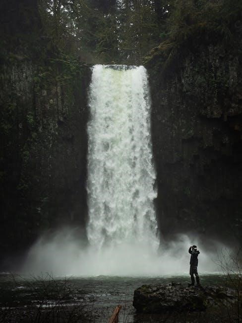
River level data is an invaluable tool for anglers and recreational enthusiasts in Oregon, providing crucial insights for planning safe and successful outings. For fishing, understanding river levels is paramount to locating optimal fishing spots. Different fish species thrive at specific water levels and flow rates, influencing their feeding habits and distribution. High water levels can scatter fish and make wading dangerous, while low water levels may concentrate fish in smaller areas but also make them more wary.
Kayakers, rafters, and other water sports enthusiasts rely on river level data to assess the navigability and safety of waterways. High water levels can create challenging rapids and increase the risk of hazards, while low water levels may expose rocks and obstacles, making navigation difficult. By monitoring river levels, recreational users can make informed decisions about where and when to engage in their chosen activities, ensuring a safe and enjoyable experience. Stay informed about flooding and river levels in your area. Check out your favorite Oregon river levels and prepare for your next fishing adventure.